Report 125 By D.E. White, U.S. Geological Survey | February 1971 (reprinted January 1987)
Note - this report is published online in two parts due to file size considerations
Note: oversized, fold-out map figures were scanned separately from the body of the report above, so "missing pages" in the report are actually figures below.
- Report 125 - Water Resources of Ward County, Texas - Part A
- Report 125 - Water Resources of Ward County, Texas - Part B
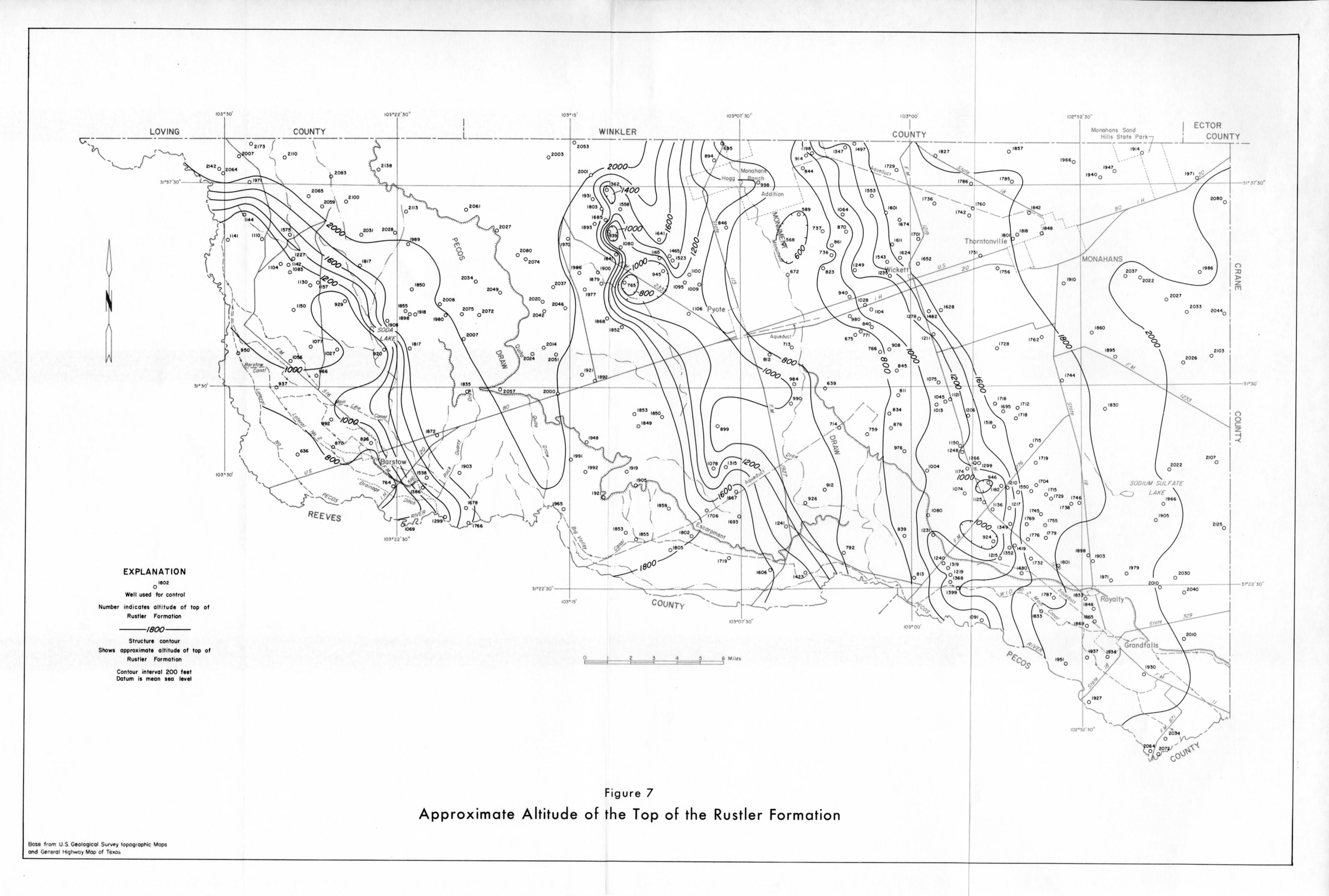
- Figure 7 - Approximate Altitude of the Top of the Rustler Formation
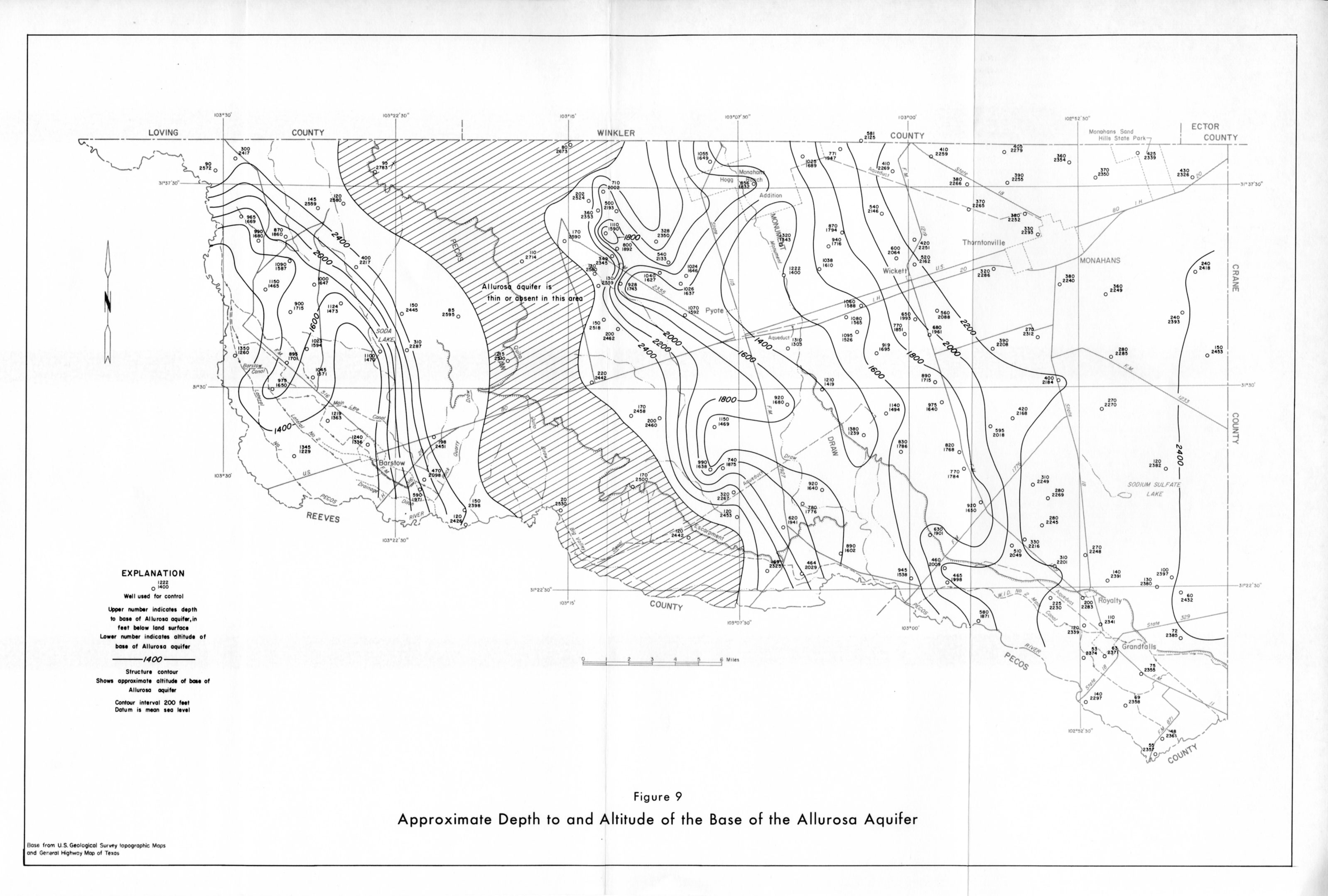
- Figure 9 - Approximate Depth to and Altitude of the Base of the Allurosa Aquifer
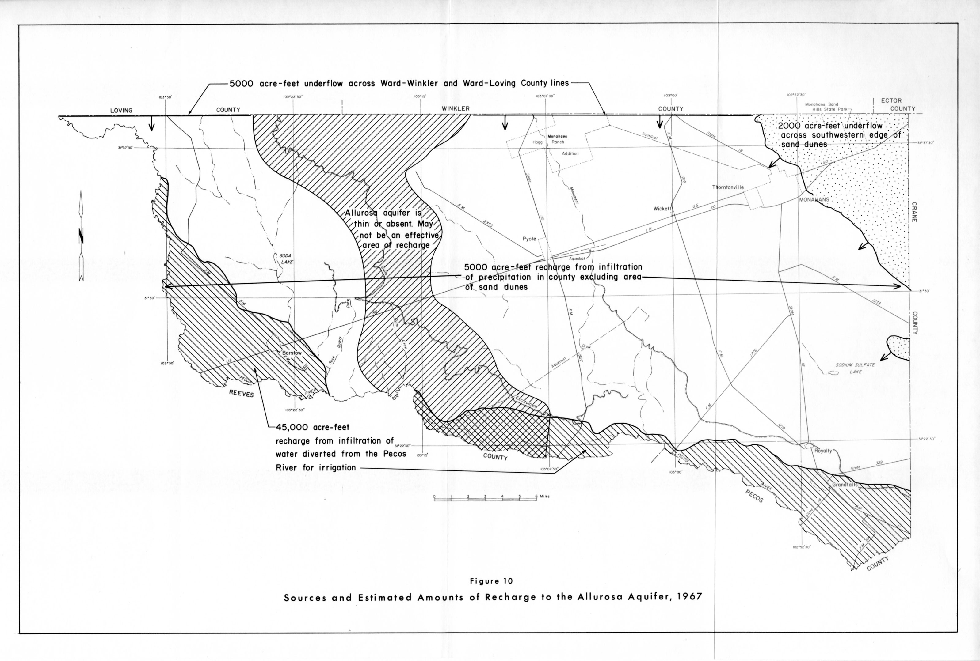
- Figure 10 - Sources and Estimated Amounts of Recharge to the Allurosa Aquifer, 1967
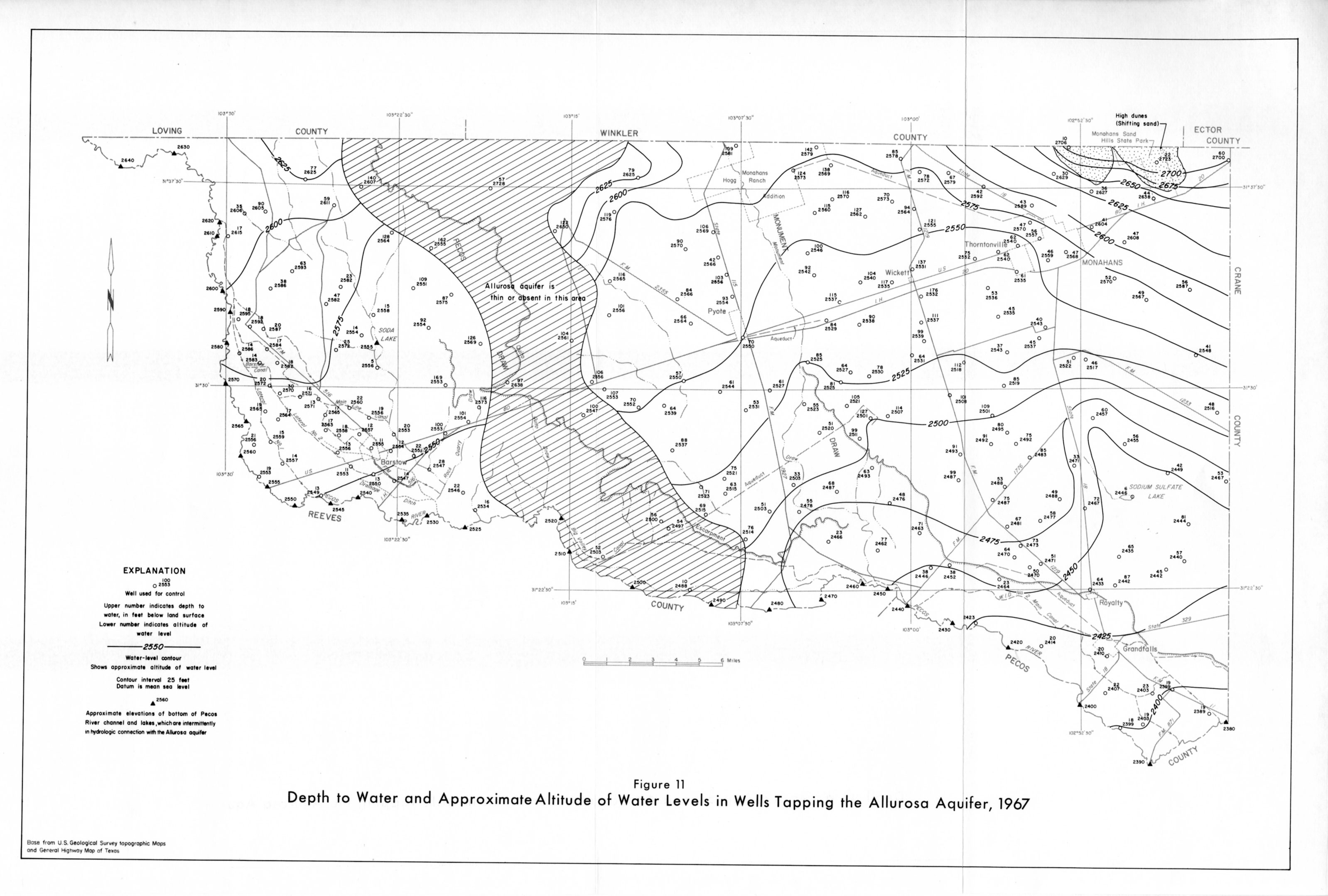
- Figure 11 - Depth to Water and Approximate Altitude of Water Levels in Wells Tapping the Allurosa Aquifer, 1967
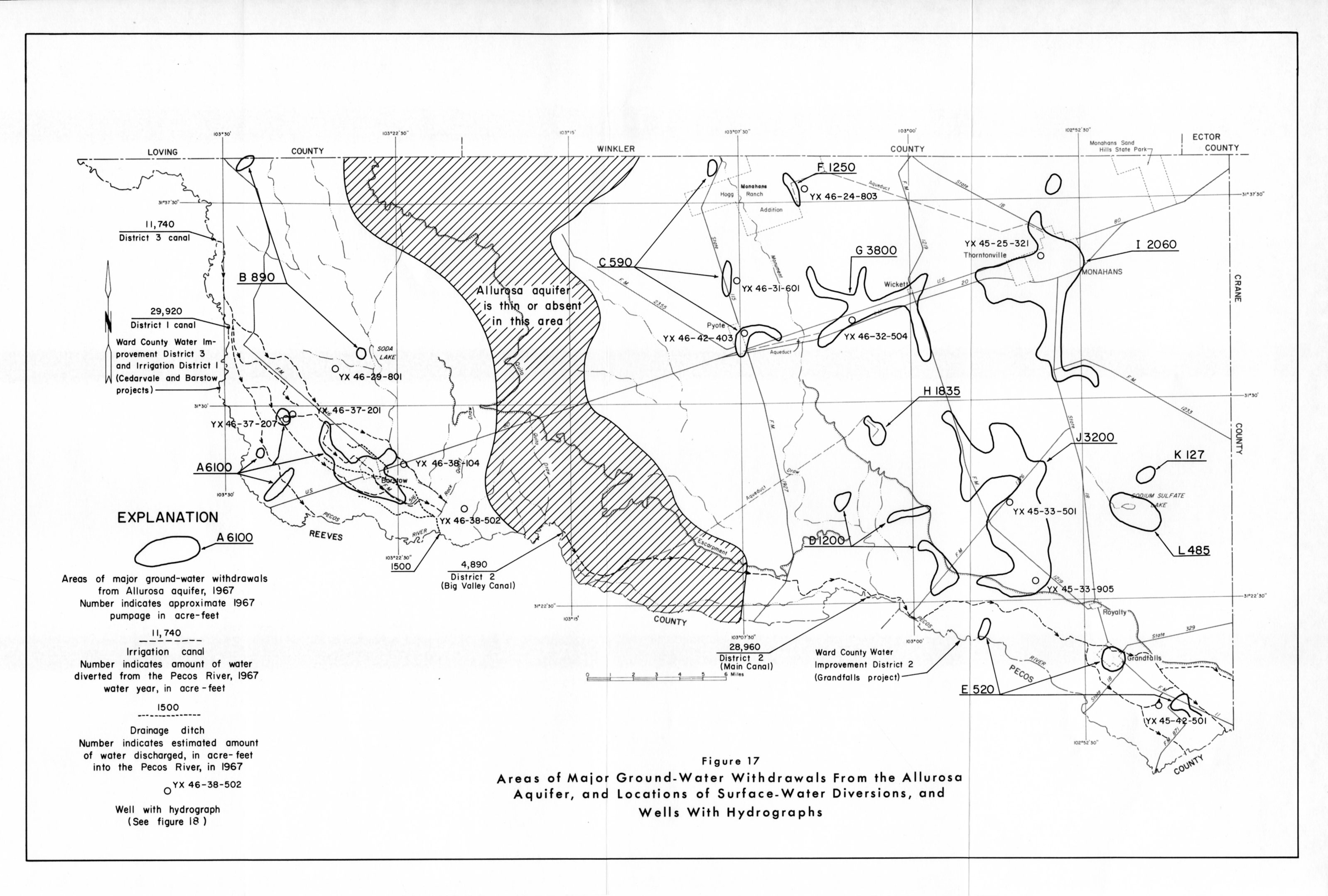
- Figure 17 - Areas of major Ground-Water Withdrawals Fron the Allurosa Aquifer, and Locations of Surface-Water Diversions, and Wells With Hydrographs
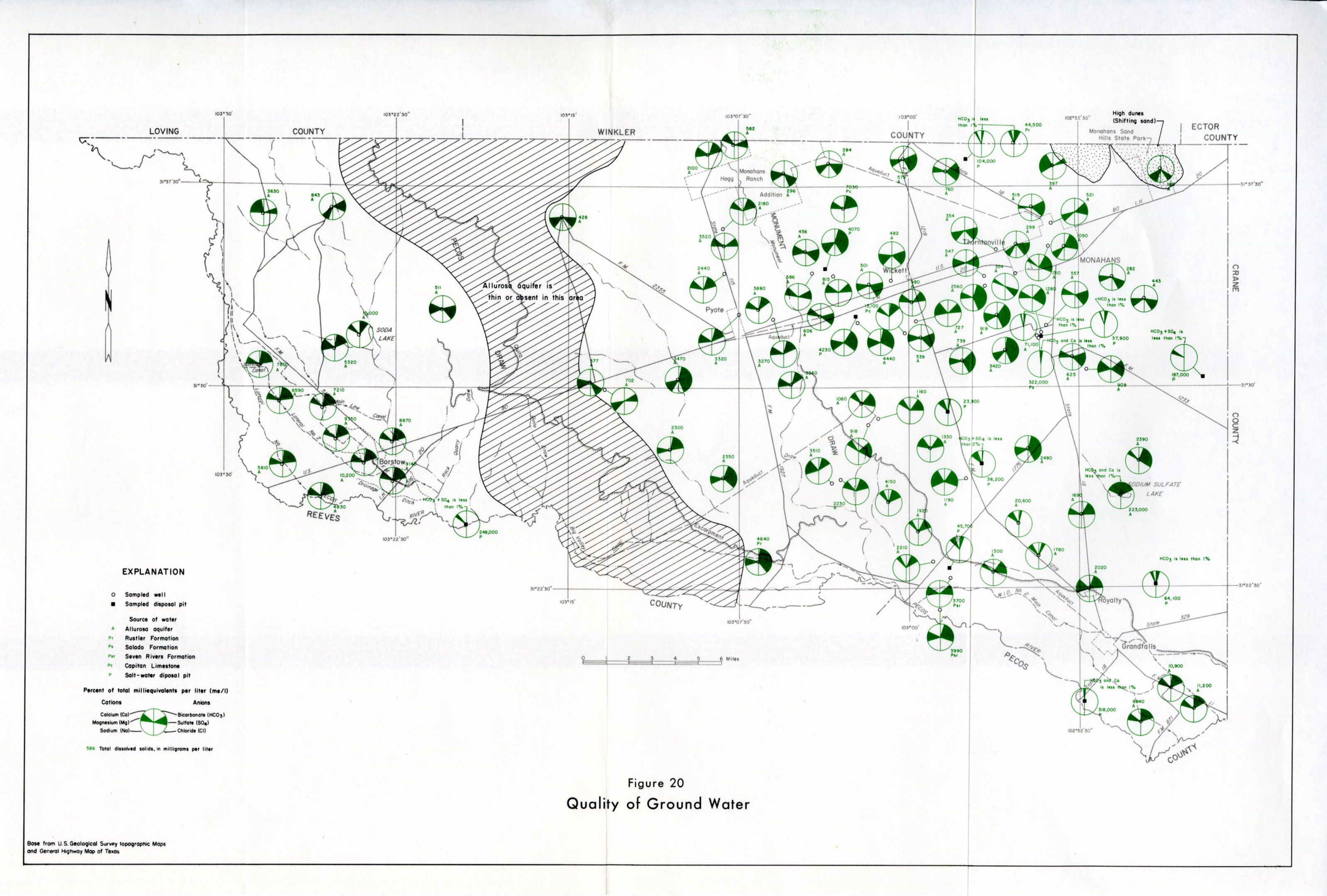
- Figure 20 - Quality of Ground Water
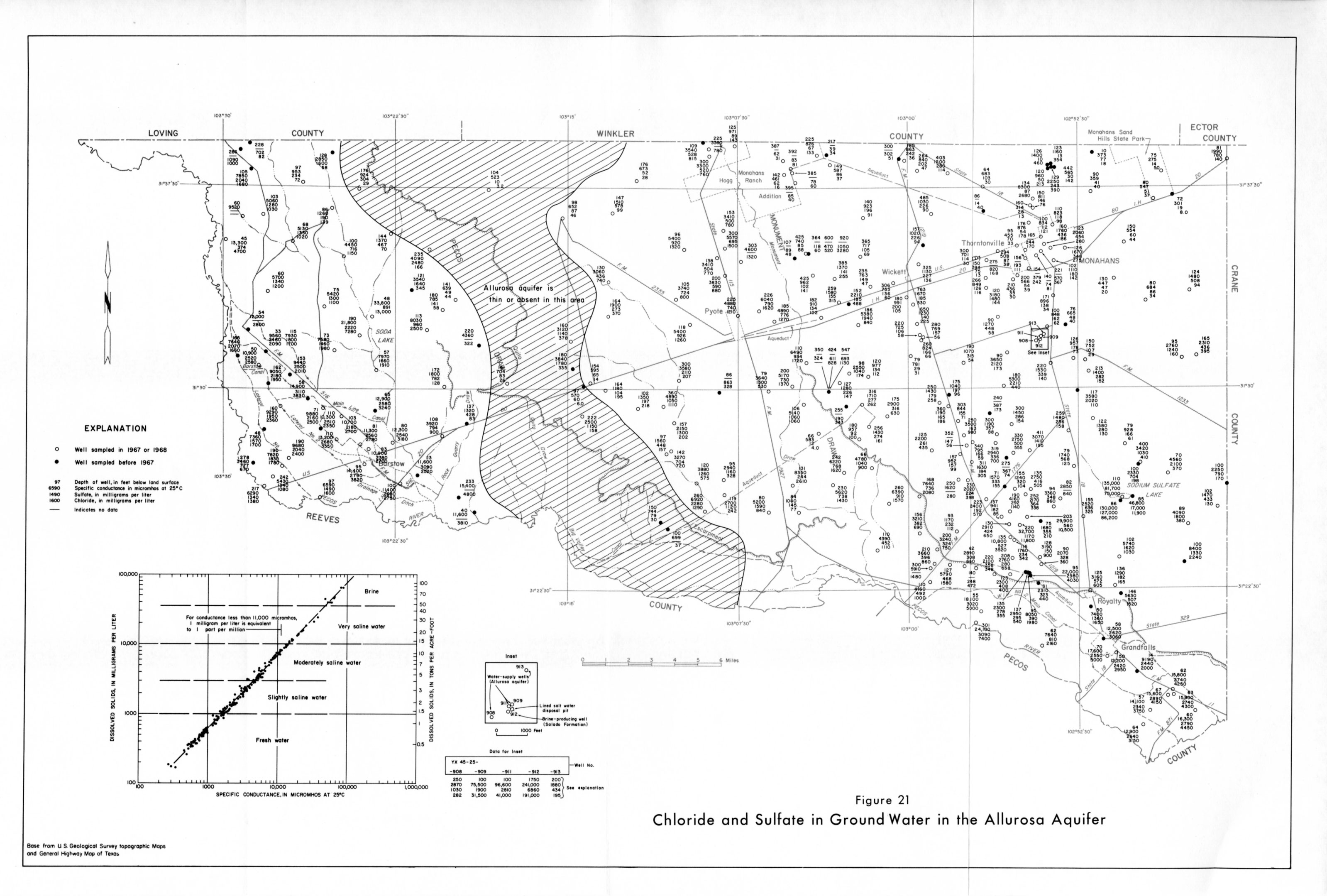
- Figure 21 - Chloride and Sulfate in Ground Water in the Allurosa Aquifer
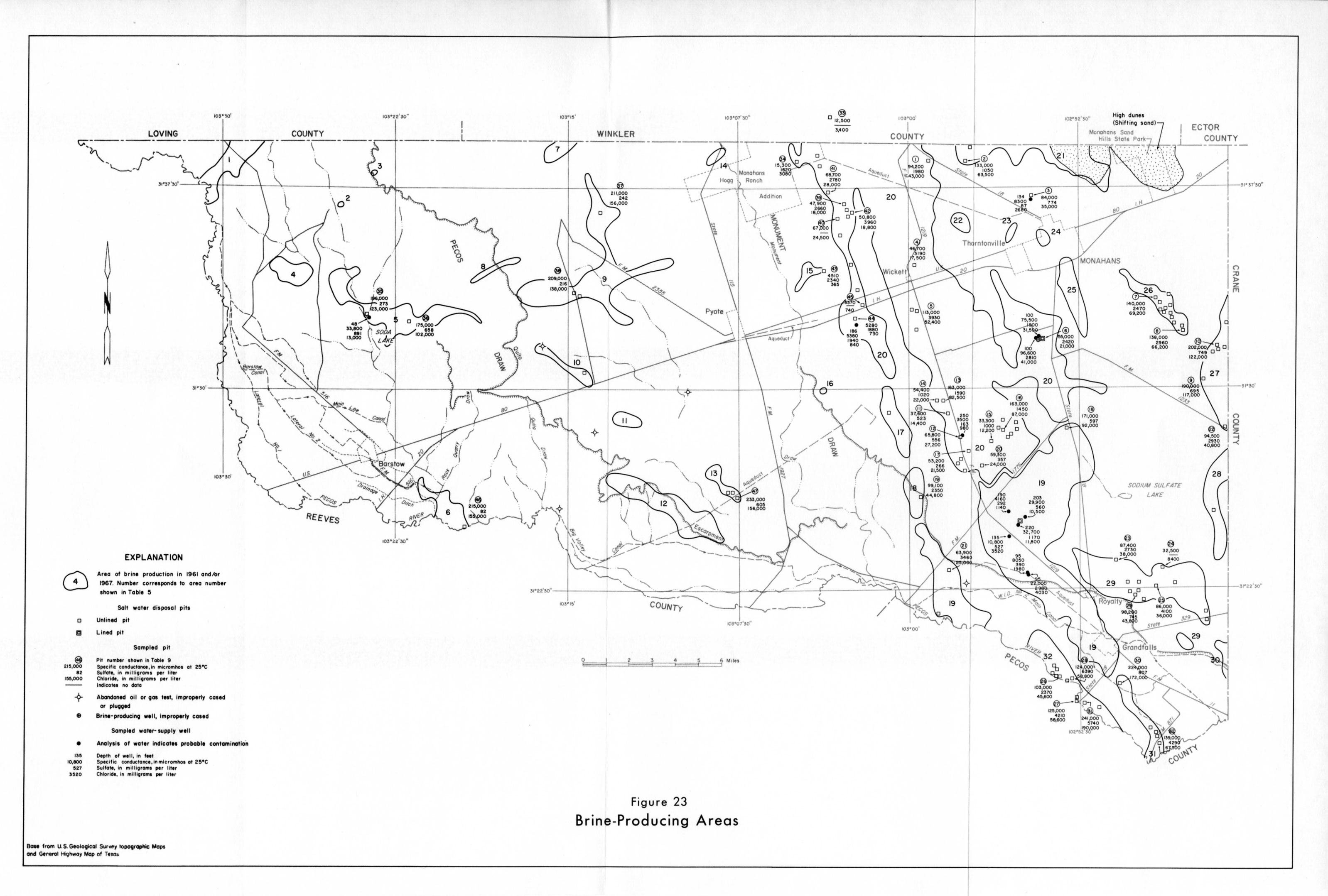
- Figure 23 - Brine-Producing Areas
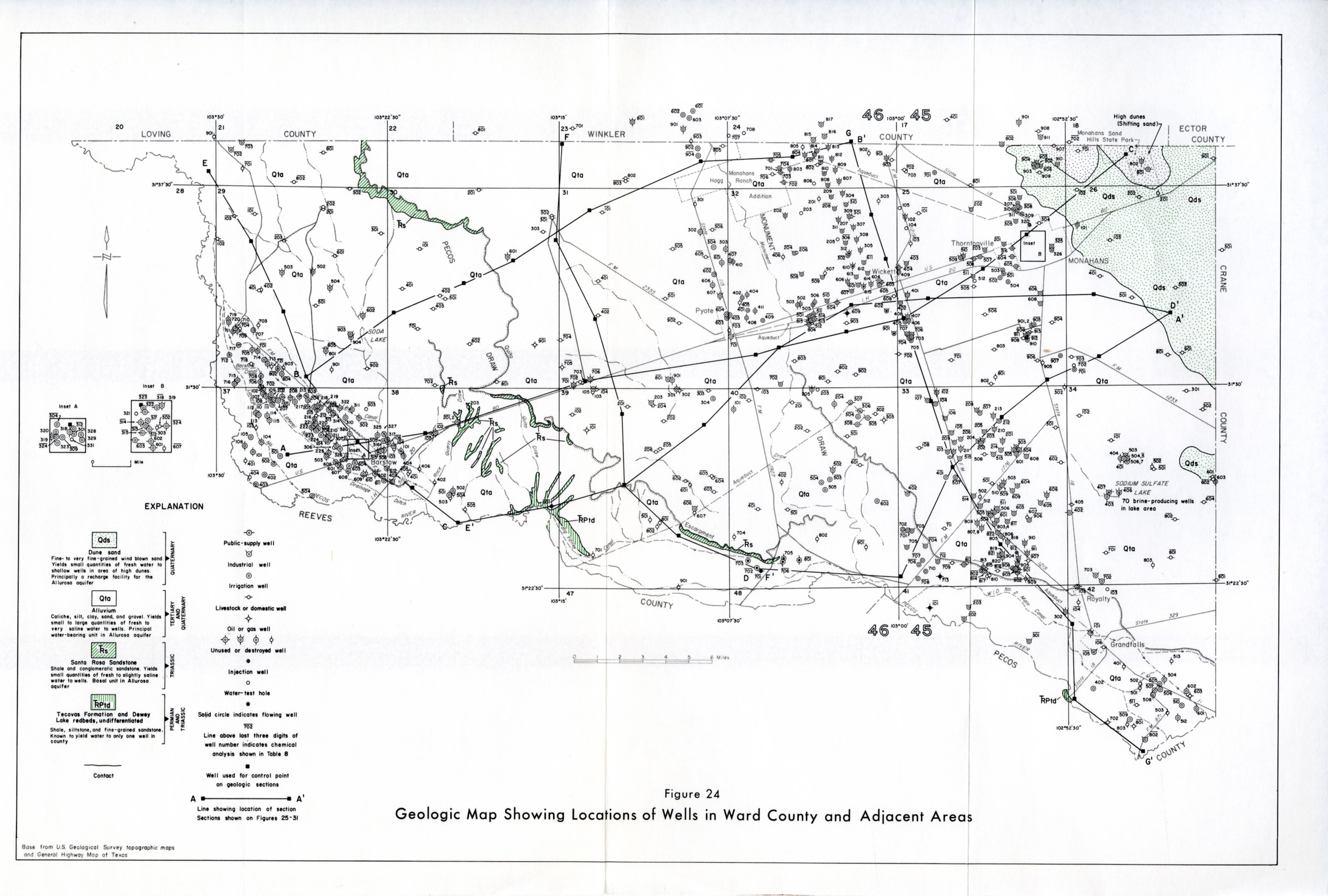
- Figure 24 - Geologic Map Showing Locations of wells in Ward County and Adjacent Areas
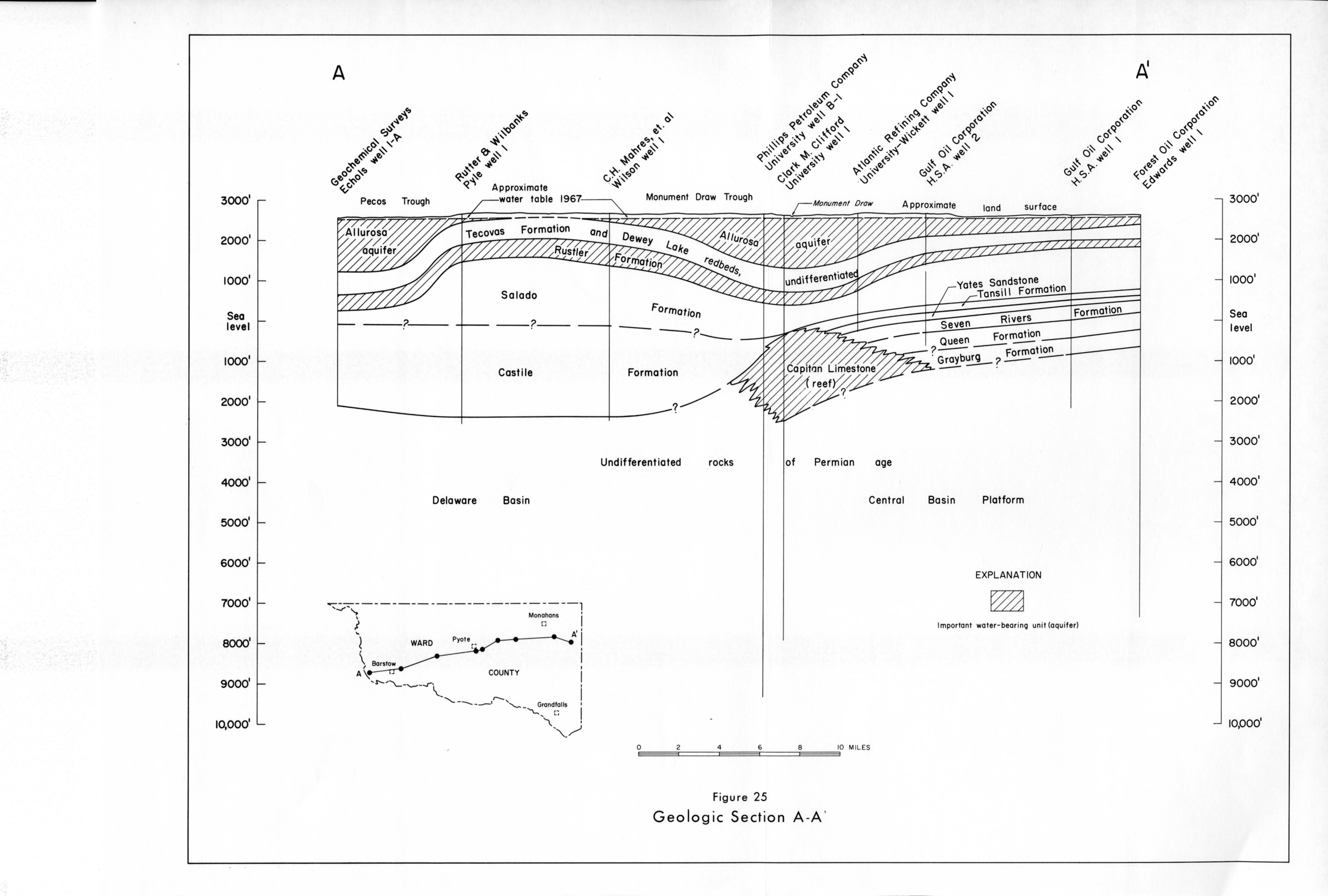
- Figure 25 - Geologic Section A-A'
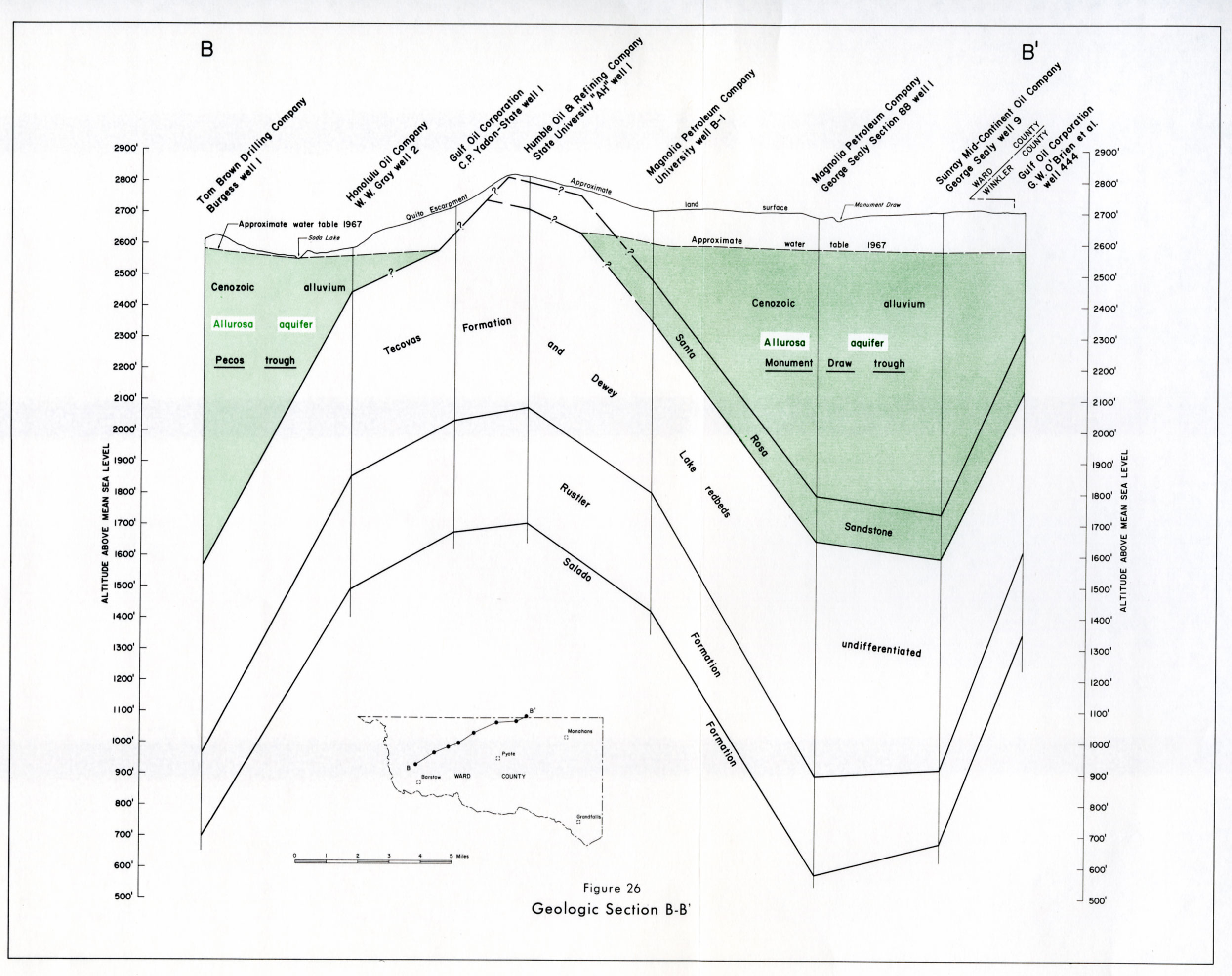
- Figure 26 - Geologic Section B-B'
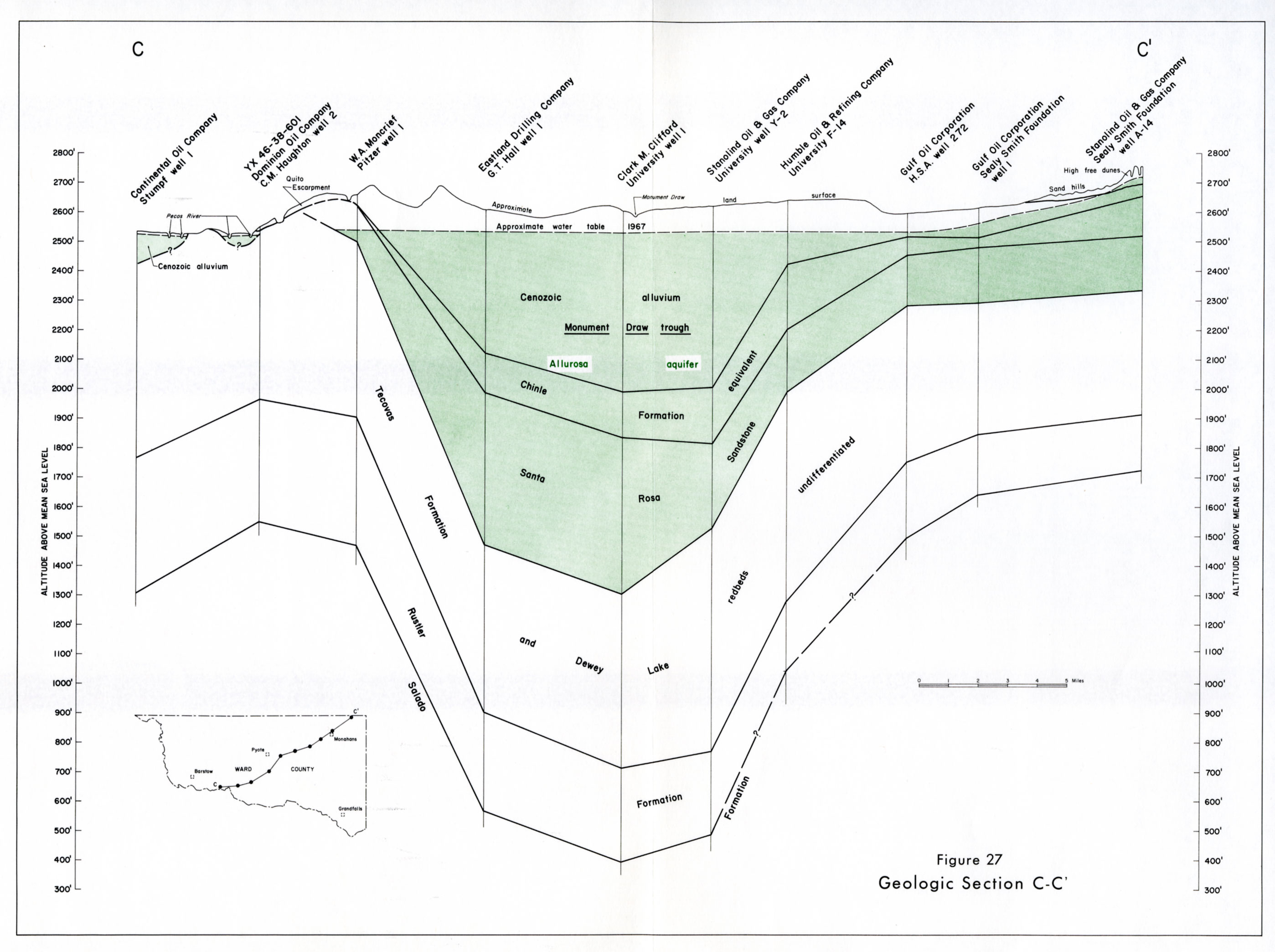
- Figure 27 - Geologic Section C-C'
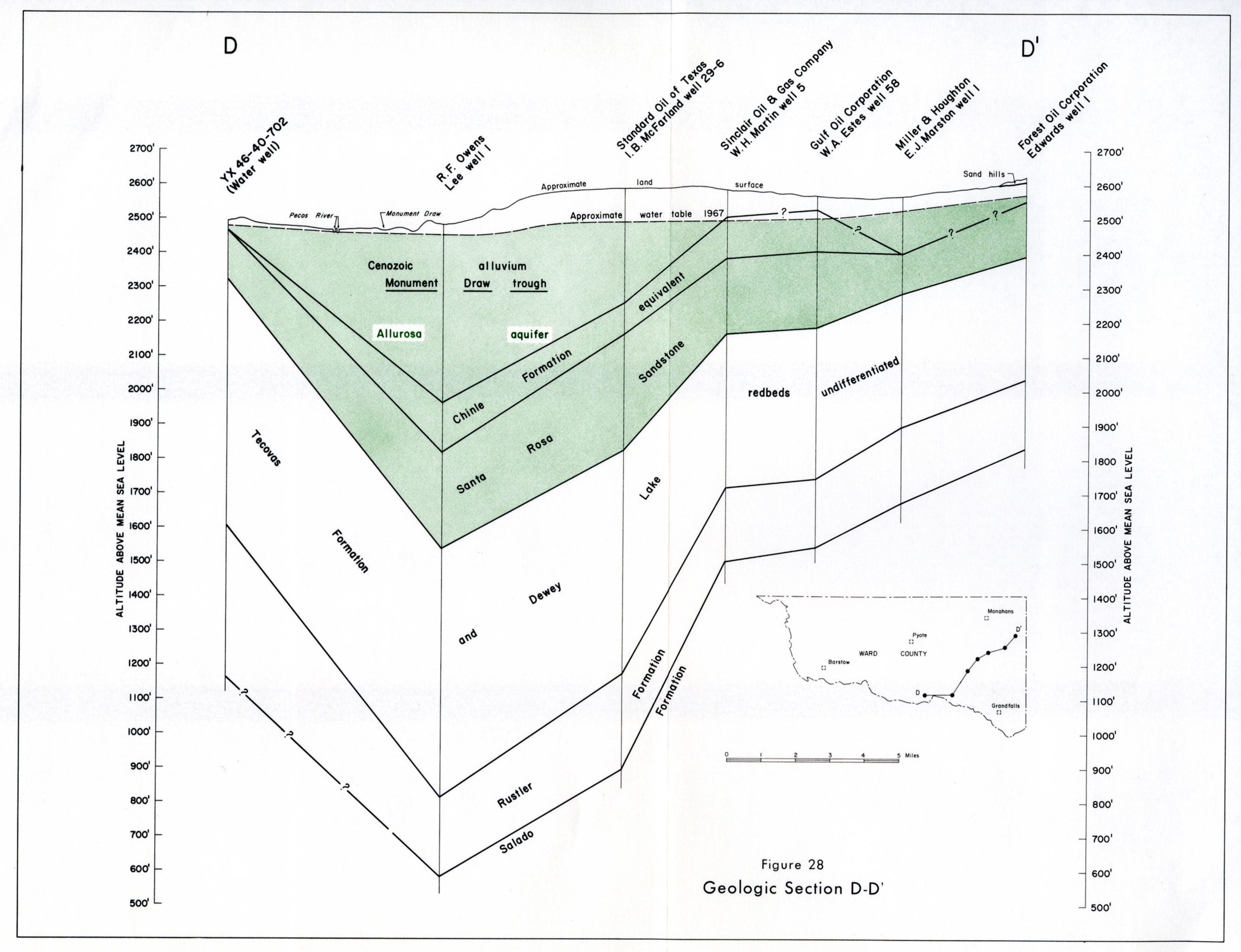
- Figure 28 - Geologic Section D-D'
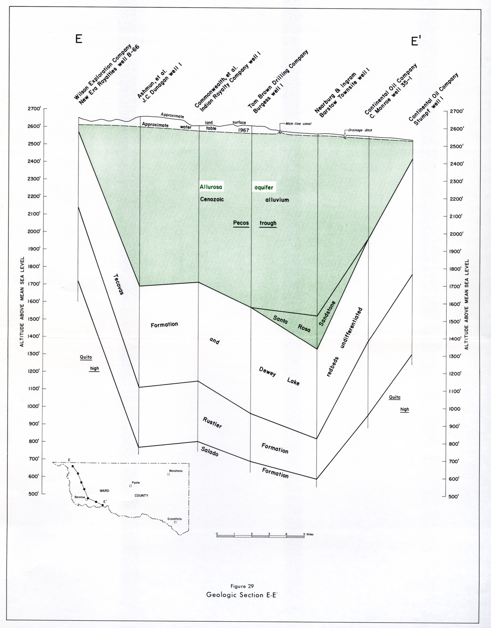
- Figure 29 - Geologic Section E-E'
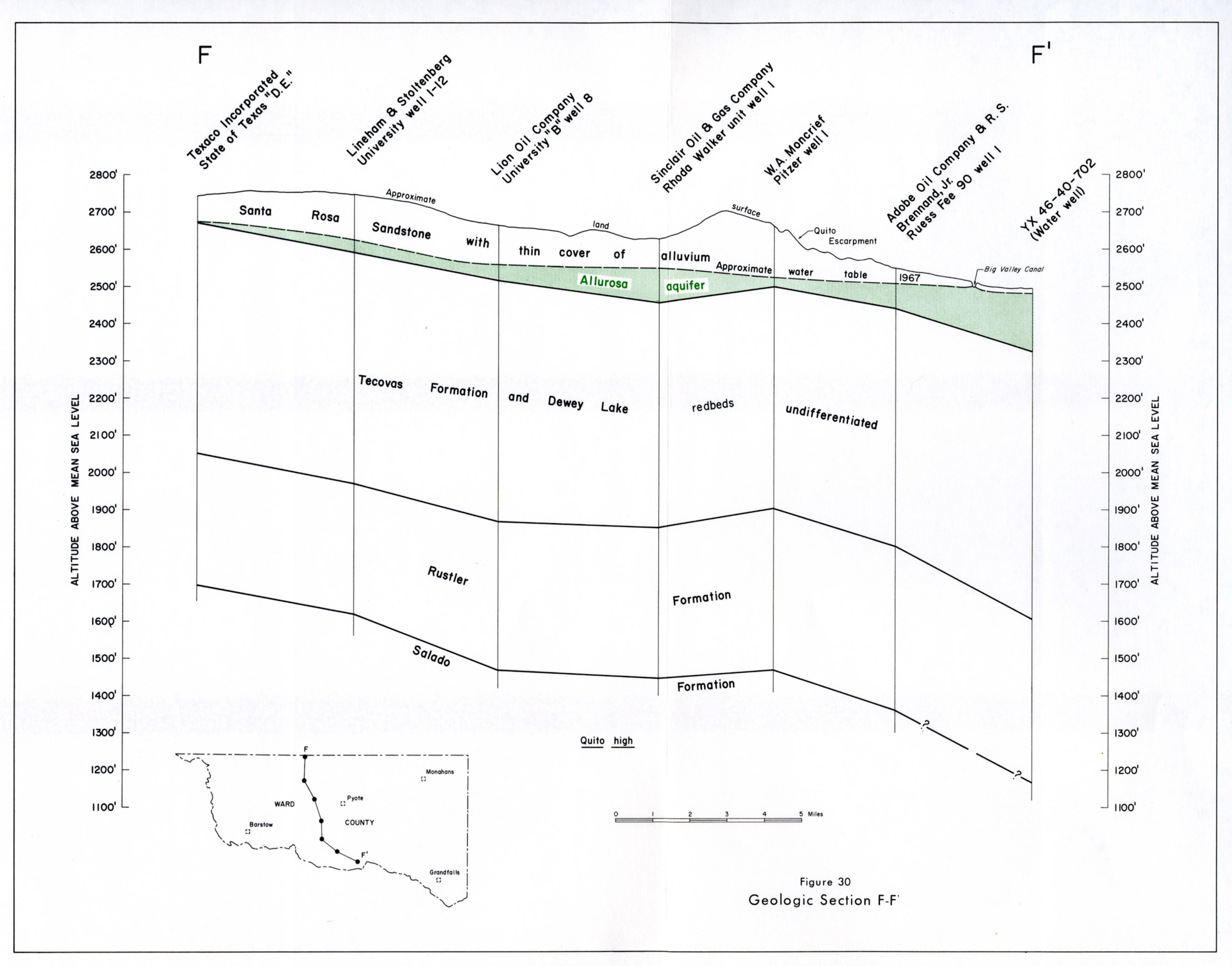
- Figure 30 - Geologic Section F-F'
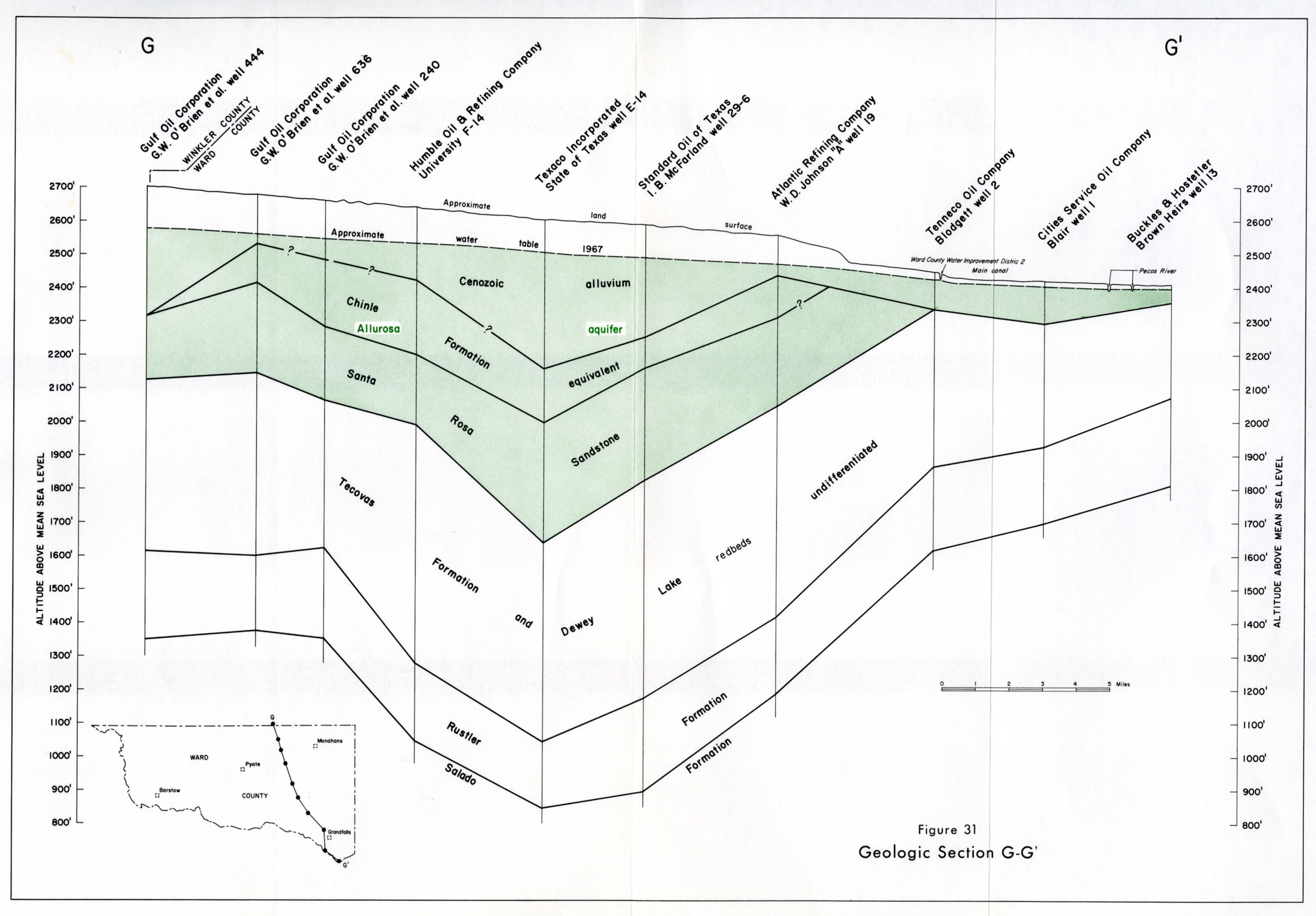
- Figure 31 - Geologic Section G-G'